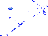
- Thumbnail

- Resource ID
- 76a49126-9452-11ea-a402-000c2931b24c
- Title
- Ethiopian Lake
- Date
- May 12, 2020, 8:14 a.m., Publication
- Abstract
- Projected Coordinate System: WGS_1984_UTM_Zone_37N
Source:Ethiopian Road Authority (ERA)
- Edition
- --
- Owner
- admin
- Point of Contact
- ad@m.in
- Purpose
- For COVId 19 Analysis and Mapping
- Maintenance Frequency
- unknown
- Type
- vector
- Restrictions
- formal permission to do something
- License
- Public Domain
- Language
- eng
- Temporal Extent
- Start
- --
- End
- --
- Supplemental Information
- No information provided
- Data Quality
- --
- Extent
-
- long min: 162434.766402054000000
- long max: 861260.124692035000000
- lat min: 490151.588718400000000
- lat max: 1594834.063621830000000
- Spatial Reference System Identifier
- EPSG:32637
- Keywords
- no keywords
- Category
- Oceans
- Regions
-
Ethiopia
